 |
Volcanic hazard perceptions |
|
|
Volcanic hazard perceptions |
Abstract
This paper describes the results of a survey of the community perceptions of volcanic hazard issues in the town of Inglewood, 20 km northeast of the potentially active Egmont volcano. Despite the belief that volcanic hazards were unlikely to occur in a resident's lifetime the majority believe that an eruption would threaten their personal safety. There is a good awareness that ash fall is a likely hazard to affect Inglewood but the lahar hazard is one that may be underestimated or misunderstood. The study supports the notion that the public frequently have a low personal interest in risk but a high expectation of government responsibility.
Understanding a community's perceptions of risk is an important part of the decision making process as the public's perception of risk is often found to be biased (Slovic 1987, Gough 1990). Misconceptions often need to be corrected to facilitate effective community response, planning and use of resources in the face of a range of hazards. A complex array of environmental, social and psychological factors shape perceptions of risk and over the past few decades research has shown that risk perception is related to hazard awareness and hazard knowledge, and influences planning behaviour and warning compliance (Mileti & Sorensen, 1990; Mileti & Fitzpatrick, 1992; Mileti & O'Brien, 1993; Lindell, 1994). Understanding of public perceptions of risk is therefore an important input into natural hazard management (Gough, 1997) and community/school-based education (Ronan & Johnston, 1997).
The purpose of this paper is to describe the results of a survey of community understanding of volcanic hazard issues in the town of Inglewood.
Inglewood is a small town of ~2800 people located 20 km to the northeast of the potentially active andesite-dacite composite volcano of Egmont (also named Mount Taranaki) (Figure 1). The town is a service centre for the surrounding farmland and dairy processing industries.
The Egmont Volcano is about 130,000 years old, and has a complex history of multiple cone building episodes followed by cone collapse when much of the cone was destroyed by huge debris avalanches (Neall & Alloway 1986). Most of the actual mountain seen today is only about 10,000 years old and has rapidly built up since the last major collapse. The latest eruption is thought to have occurred in 1755 AD (Neall & Alloway, 1986). Investigations of the tephrostratigraphy of the past c. 30,000 years on the volcano's eastern ring plain (including the area encompassing Inglewood) suggests a minimum average return period of eruptions of c. 330 years (Alloway et al., 1995). However, due to the low preservation potential of small magnitude eruptions in the soil forming environment beyond the National Park boundary this average return period may be shorter. The Inglewood area has been frequently inundated by tephra falls prior to the arrival of Europeans. The town is a therefore vulnerable to tephra falls (ash and lapilli) should Egmont become active. These falls will be tend to be disruptive not destructive when less than 100 mm, affecting services such as water, sewerage, electricity, transportation and are a nuisance to humans and animals. Falls thicker than ~100 mm have more significant and damaging impacts (Johnston & Houghton, 1995). A revised volcanic hazards map for Taranaki Region was released in 1996 (Neall & Alloway, 1996), focusing on the destructive and life-threatening hazards (lahars, pyroclastic flows and debris avalanches). The town of Inglewood is located in a zone of intermediate hazard, representing areas that have been inundated by lahars and associated floods with a recurrence interval from 3,500 - 23,000 years. All households have received literature from the regional council informing them of which hazard zone they are located within and actions to be taken in the event of an eruption.
In August 1997, 50 participants completed a pilot survey questionnaire from a random selection of 25 households in the town of Inglewood and a group of 25 students from the local high school. No students were from the 25 households surveyed. The questionnaire contained 10 questions on perceived vulnerability to natural hazards, personal and community preparedness and levels of awareness of volcanic hazards. Owing to the small sample size the data was analysed together.
The first issue to be examined was that of perceived likelihood of natural hazards affecting Inglewood residents in their lifetime. Five major hazards were assessed: volcanic eruptions, earthquakes, floods, cyclones and tornados. For each hazard respondents ranked the likelihood on a 5 - point scale (extremely likely = 1, very likely = 2, 50/50 = 3, very unlikely = 4, extremely unlikely = 5) (Table 1). Earthquakes, cyclones and tornadoes were ranked as likely to occur in respondent's lifetime (i.e. mean less than 3), with earthquakes viewed as being the most probable rated between very likely to extremely likely. Volcanic eruptions and floods were both perceived as being moderately unlikely (i.e mean greater than 3) rated between the even odds and very unlikely categories.
Table 1 Perceived likelihood of natural hazards events in respondents lifetimes
| mean (rank) | s.d. | n | |
|
Volcanic eruption Earthquake Flood Cyclone Tornado |
3.26 (4) 1.96 (1) 3.41 (5) 2.61 (3) 2.60 (2) |
1.04 0.98 1.24 1.03 0.97 |
43 49 46 46 48 |
1 = extremely likely, 2 = very likely, 3 = 50/50,
4 = very unlikely, 5 = extremely unlikely
The remaining questions focused exclusively on volcanic hazard issues. In the event of volcanic eruption, respondents ranked the likelihood of physical risk ("how likely is it that it will seriously threaten your personal safety?") on a 5-point scale (extremely likely = 1, very likely = 2, 50/50 = 3, very unlikely = 4, extremely unlikely = 5) (Table 2). A volcanic eruption were ranked as likely to threaten personal safety if they occurred in the future (i.e. means less than 3).
Table 2 Respondents' mean score for the perception that personal safety is threatened by volcanic hazards
| mean | s.d. | n | |
| threat to personal safety | 2.21 | 1.15 | 48 |
Respondents were asked to identify what volcanic hazards they were aware of and this list is shown in Table 3. Most people readily identified ash (91.5 %) and lava (80.9 %) as a volcanic hazard. Almost half listed lahars/flooding and a quarter identified gas. Only a few (<5 %) could name other hazard types. Respondents were then asked to identify which hazards could affect Inglewood. A large majority identified ash falls (78.7 %) and just under a third (31.9 %) listed lava flows and lahars/flooding. Four respondents (8.5 %) believed gas was a hazard in Inglewood and less than 5 % reported other hazards.
Table 3 Volcanic hazards identified and those believe to have the potential to affect Inglewood.
|
Hazard type |
Identified hazards % |
n
|
Hazards affecting Inglewood % |
n
|
|
ash lava lahars/flooding gas earthquakes pyroclastic flows landslides direct blast acid rain |
91.5 80.9 50.0 25.5 4.3 4.3 2.1 2.1 2.1 |
43 38 25 12 2 2 1 1 1 |
78.1 31.9 31.9 8.5 4.3 2.1 2.1 2.1 0 |
37 15 15 4 2 1 1 1 0 |
The level of preparedness of local/regional government and public officials for future volcanic eruptions was ranked by respondents, along with their perceived personal preparedness, on a 4-point scale (very prepared = 1, somewhat prepared = 2, not very prepared = 3, not prepared at all = 4). The level of preparedness for volcanic hazards amongst local/regional government (i.e. local and regional civil defence, Police, Fire Service) was rated between very prepared and somewhat prepared (i.e. mean score less than 2) (Table 5). Personal preparedness rated between not very prepared and not prepared at all.
Table 4 Mean scores of levels of government and personal preparedness for volcanic hazards.
| mean | s.d. | n | |
|
local/regional government personal |
1.88 3.16 |
0.60 0.67 |
48 50 |
1 = very prepared, 2 = somewhat prepared,
3 = not very prepared, 4 = not prepared at all
The study asked if individuals had undertaken any protective measures in view of possible volcanic hazards and listed a number of options to choose from: purchased insurance, planned evacuation routes, obtaining battery powered radio and having supplies of food and water. Just over half of respondents (58.0 %) of respondents claimed to have undertaken protective measures (Table 5). However, the overall level of protective actions taken in households may be higher as the sample contains a large number of school children who may not have personally undertaken such actions but may come from a household that has. Of those who have undertaken protective actions purchasing insurance was the most popular measure (72.4 %) followed by obtaining battery operated radio (44.8 %), planning evacuation routes and a place to stay (27.6 %) and maintaining emergency supplies of food and water (24.1 %). Other options were given by 13.8 % of respondents.
Table 5 Protective measures undertaken in view of volcanic hazards.
|
%
|
n
|
|
|
yes no |
58.0 42.0 |
29 21 |
|
purchased insurance Planned evacuation Obtained battery radio Emergency food and water Other |
72.4 27.6 44.8 24.1 13.8 |
21 8 13 7 4 |
The final section of the questionnaire provided an opportunity for respondents to add their own comments on volcanic hazard issues. All comments are listed in Table 6 in an unedited form.
Despite the belief that volcanic hazards were unlikely to occur in respondent's lifetimes the majority believed that an eruption would threaten their personal safety. The finding has significant implications should an evacuation of Inglewood be required in a future emergency. The response to warnings by individuals has been found to relate to i) individual risk perception; ii) the nature of the warning information; and iii) the personal characteristics of the recipient (Mileti & O'Brien, 1993) therefore perceiving there is a threat is a useful public attitude for encouraging evacuation compliance. However, the lack of personal belief in the likelihood of an eruption in an individual's lifetime may reduce the amount personal preparedness. This study also support the notion that the public frequently have a low personal interest in risk but a high expectation of government responsibility.
There is a good awareness that ash falls are a likely hazard to affect Inglewood and this is realistic as the town is close to the volcano (~ 20 km away). Although not tested in this survey the recent eruptions of Ruapehu (1995-1996) may have contributed to this awareness as ash falls were widespread in the North Island and had significant impacts on a number of infrastructure sectors, such as air-transport (Johnston, 1997). The lahar hazard appears to be underestimated or misunderstood by residents. Only half of the respondents identified lahars or flooding as a hazard and less than a third believed lahars or flooding could be a hazard affecting Inglewood despite the town being given a moderate risk by Neall & Alloway, (1996). The suggestion by almost a third of respondents that lava flows are a hazard in Inglewood is an interesting result. Andesite and dacite lava flows (which Egmont produces) seldom flow more than a few kilometres from source and are unlikely to reach Inglewood. However, the popular "Hollywood" view of volcanoes, with extensive fast moving fluid flows (similar to the basaltic flows of Hawaii) may have contributed to this perception.
The data presented in this paper was collected as part of a pilot study and is limited in the number of issues investigated. However, this should not take away from the value of the findings presented, as they do represent a measure of the communities' understanding and the perceived threat of various hazard types. For volcanic hazard management strategies to be effective the hazards posed by Egmont must be well understood. Careful prior scientific analysis will provide the vital information needed for appropriate response planning. When Egmont erupts again a portion of the population will need to be evacuated therefore it is imperative that those living in areas of high risk are aware of this fact.
The data was collected by K.B. as part of an undergraduate study at Massey University. We would like to that Douglas Paton, Peter Wood and Brent Alloway for their helpfully discussion in preparing this short communication.
Alloway, B.V., Neall, V.E., Vucetich, C.G. 1995. Late Quaternary tephrostratigraphy of northeast and central Taranaki, New Zealand. Journal of the Royal Society of New Zealand 25: 385-458.
Gough J.D. 1990. A review of the literature pertaining to 'perceived' risk and 'acceptable risk' and methods used to estimate them. Information Paper No 14. Centre for Resource Management, University of Canterbury and Lincoln University.
Gough, J. 1997. Natural hazards and risk management. Tephra 15(1): 18-23.
Johnston, D.M. 1997. Physical and social impacts of past and future volcanic eruptions in New Zealand. Unpublished Ph.D. thesis, Department of Soil Science, Massey University.
Johnston, D.M., Houghton, B.F. 1995. Living with volcanoes. Tephra 14 (2), 22-28.
Lindell, M.K. 1994. Perceived characteristics of environmental hazards. International Journal of Mass Emergencies and Disasters 12(3): 303-326.
Mileti, D. S., Sorensen, J. H. 1990. Communication of Emergency Public Warnings: a social science perspective and state-of-the-art assessment. Oak Ridge Laboratory ORNL-6609.
Mileti, D. S., Fitzpatrick, C., 1992. The casual sequence of risk communication in the Parkfield earthquake prediction experiment: Risk Analysis, 9: 20-28.
Mileti, D.S., O'Brien P.W. 1993. Public response to aftershock warnings. U.S. Geological Survey Professional Paper 1553-B, 31-42.
Neall, V.E., Alloway, B.V. 1986. C3: Quaternary volcaniclastics and volcanic hazards of Taranaki. p. 101-137. In: Houghton, B.F., Weaver, S.D. (eds) North Island Volcanism: Tour guides A1, A4, and C3. 137 p. New Zealand Geological Survey record 12.
Neall, V.E., Alloway, B.V. 1996. Volcanic Hazard Map of Western Taranaki. Massey University, Department of Soil Science Occasional Report 12.
Ronan, K.R., Johnston, D.M. 1997. Children's Risk Perceptions and Preparedness: a hazards education survey. Auckland City Council - Auckland Regional Council, 54p.
Slovic, P. 1987. Perception of risk. Science 236, 280-285.
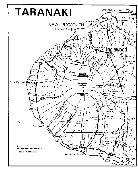
Figure 1: Location map of Inglewood and the Egmont volcano in the Taranaki Region. (modified from Neall & Alloway 1991).
